 PUEBLO, CO / PREDEVELOPMENT
Federal Building Predevelopment
Establishing a foundational structural assessment and feasibility framework. This critical phase integrates historic preservation values with adaptive modern reuse planning.
UC Studios approaches complex urban, historic, industrial, and destination sites as integrated development systems. By bringing architecture, urban design, landscape, infrastructure, engineering, and economic strategy together, we create commercial, mixed-use, residential, research and medical, industrial, and destination environments that respond to their setting and purpose. From high-density urban redevelopment and adaptive reuse to major campuses and remote resorts, our work transforms challenging sites into resilient, economically viable places built for lasting value.
The 4‑Main development brings together historic preservation and new investment to renew a key downtown Pueblo block. The project restores the historic Colorado Theater as a cultural anchor while integrating a neighborhood grocery market, senior and mixed-income rental housing, and a City-funded parking structure. Together, these complementary uses create an inclusive, walkable destination that supports daily life, strengthens downtown activity, and generates lasting community value.
Transforming Rochester's monumental industrial footprint into a thriving regenerative infrastructure. Through the synthesis of visionary architectural mapping, adaptive physical reuse, and next-generation ecological engineering, the Kodak Hawkeye Campus sets a bold template for global industrial rebirth and shared community stewardship.
Deep architectural spatial analysis, historical archival parsing, and continuous diagnostic site mapping.
Structuring high-density, biophilic civic envelopes that organically preserve historic industrial identity.
Data-backed modeling, phased infrastructure scaling, and robust performance analytics.
Structuring highly resilient legal alignments, federal historic incentives, and public investments.
Weaving net-zero loops, advanced micro-energy grids, and restorative ecological water corridors.
Dynamic co-design hubs, immersive community workshops, and equitable planning models.
A visionary spatial restoration projecting historic monumental legacy directly into the future. By seamlessly integrating structural preservation with low-carbon mechanical platforms, the Colorado Theater emerges as a vibrant, carbon-positive hub for modern theatrical performance and shared civic arts.
PUEBLO, CO / PREDEVELOPMENT
Establishing a foundational structural assessment and feasibility framework. This critical phase integrates historic preservation values with adaptive modern reuse planning.
 LOS ANGELES, CA / INFRASTRUCTURE
Evaluating community funding patterns and infrastructure financing systems. Formulating equitable economic strategies to support sustainable public transit projects.

Strategically positioned along the vital Colorado River corridor, the economic planning framework for Parachute leverages massive mountain panoramas and direct river logistics access to foster a modern, multi-sector industrial campus. This forward-looking development acts as a catalyst for municipal revenue, regional shipping integration, and active community plazas.
Focus: Regional logistics integration, environmental buffer design, and public-private partnership zone mapping.
This highly anticipated urban project targets the dramatic transformation of the historic Zuni Steam Plant into an active community waterfront anchor. Our plan establishes a robust spatial taxonomy that coordinates intensive environmental brownfield mitigation with clean civic access to the river edge, restoring the industrial monolith's relation to the public.
A meticulous comparative spatial study evaluating continuous trail corridors next to active industrial ports. Our research provides planners with visual and geographic tools to resolve complex land use negotiations.

FIGURE 3.1: Skuylkill River Trail — Mapping environmental buffers and recreational active transit paths through legacy industrial zones.

FIGURE 3.2: MassPort GIS Environmental Modeling — Translating commercial operations data into dynamic ecosystem mitigation strategies.
A showcase of comprehensive frameworks that seamlessly integrate high-capacity transit links, intelligent land-use, and human-scaled connectivity.

High-density mixed-use layout integrating the Union Square Link, bringing neighborhood active transit hubs directly to communities.
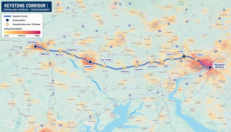
Strategic economic alignment study coordinating density corridors with regional commuter rail operations and multi-point access.
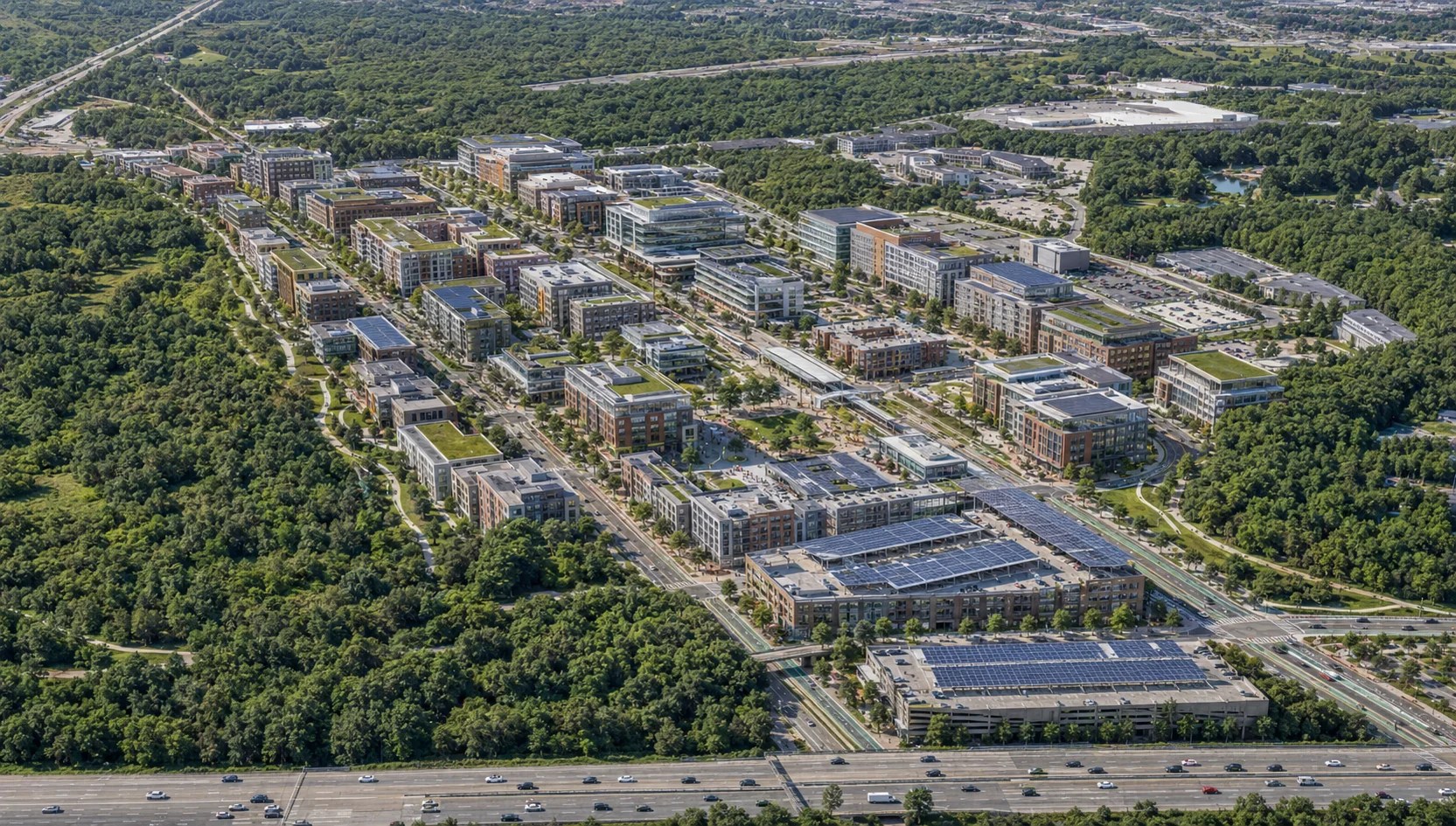
A beautiful pedestrian-focused master planning framework directly adjacent to regional rail, facilitating active local lifestyle hubs.
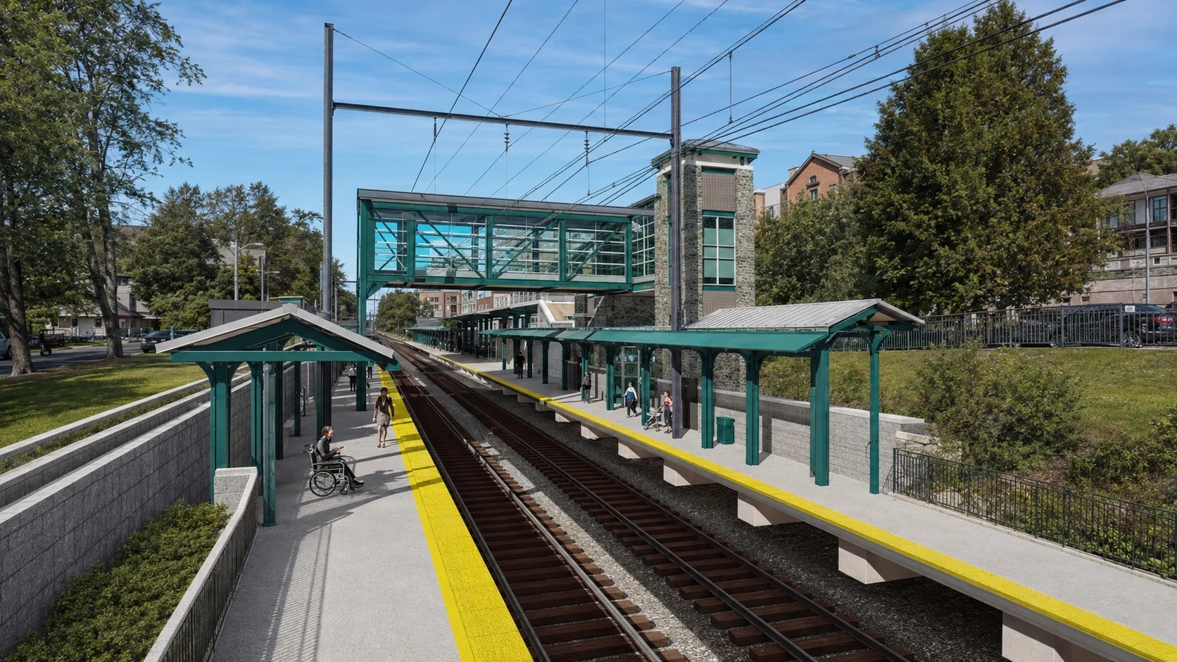
Integrating historic preservation with commuter ease, improving micro-mobility nodes and high-density station services.
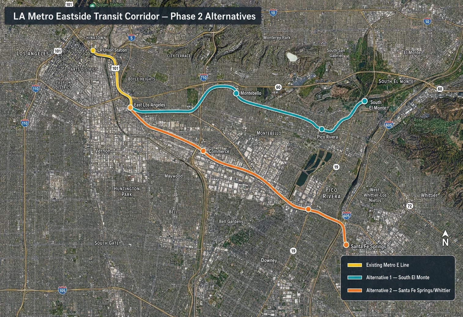
Detailed spatial and alignment planning models to maximize equity, regional connectivity, and density potentials.
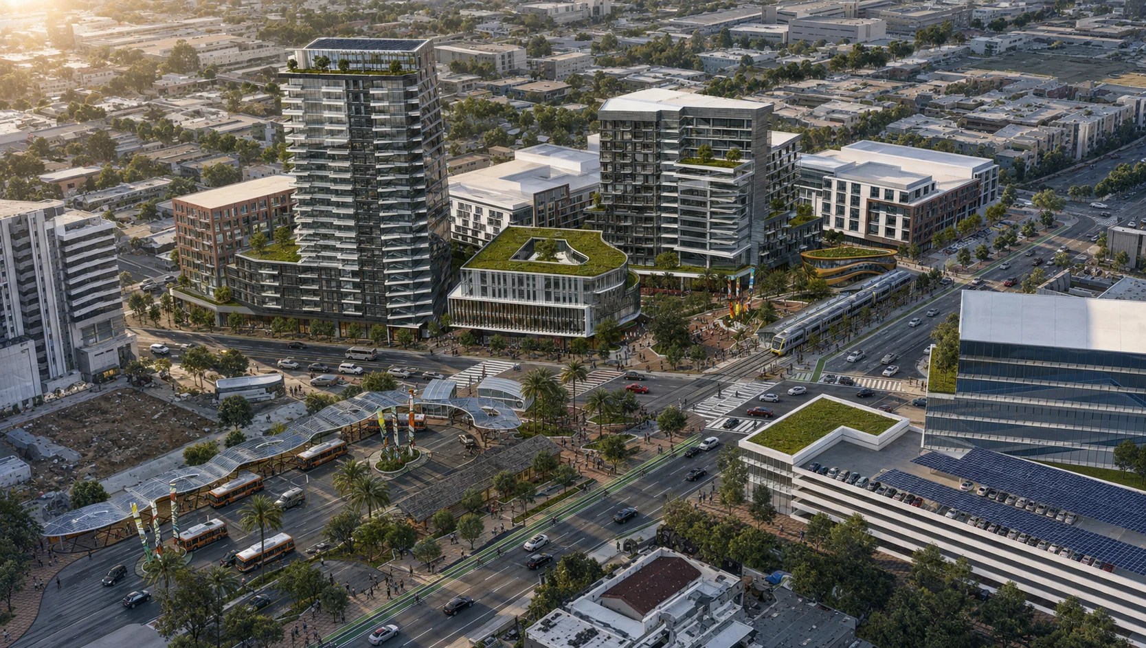
North Hollywood planning schemas designed around healthy urban corridors, active transport systems, and multi-tier public transit.
An editorial analysis of high-impact transit corridors, aeronautical development networks, and municipal masterplans shaping Philadelphia's future economic landscape.
The PHL Aerotropolis framework transforms metropolitan transit interfaces into active commercial zones. By bridging architectural strategy with logistics, the layout optimizes international supply routes and creates specialized corporate clusters directly integrated with airport operations. Modernized freight architecture, master-planned enterprise hubs, and sustainable transit loops form the core of this robust planning initiative, engineering resilience directly into the region's primary global corridor.

Through quantitative economic modeling and rigorous market assessment, this analysis outlines land-use optimizations for underutilized industrial sectors. Leveraging spatial GIS data and investment pipeline projections, the study provides a roadmap for clean manufacturing clusters, cold-storage logistics, and port-side infrastructure revitalization. The actionable insights target regional planners looking to deploy capital with maximum economic impact.
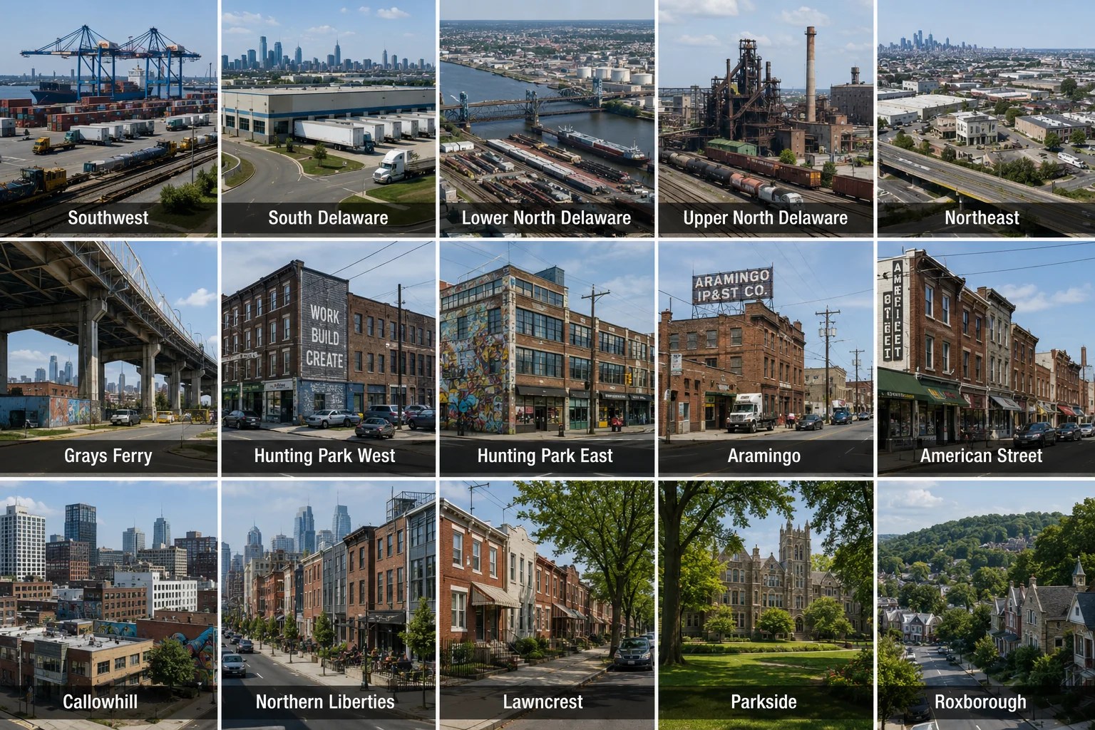
An editorial portfolio demonstrating structural spatial analysis, historic architectural overlays, complete streets development, and transit accessibility valuation dashboards.
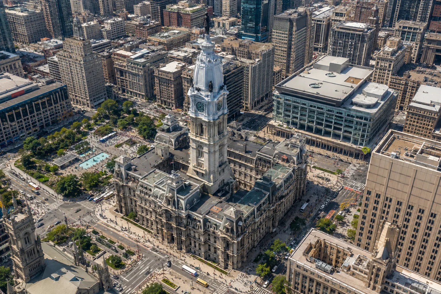 PLACE-BASED PLANNING
A detailed local zoning diagnostic overlaying multi-modal hubs with dynamic land-use code maps to streamline high-efficiency, pedestrian-accessible structural adjustments.
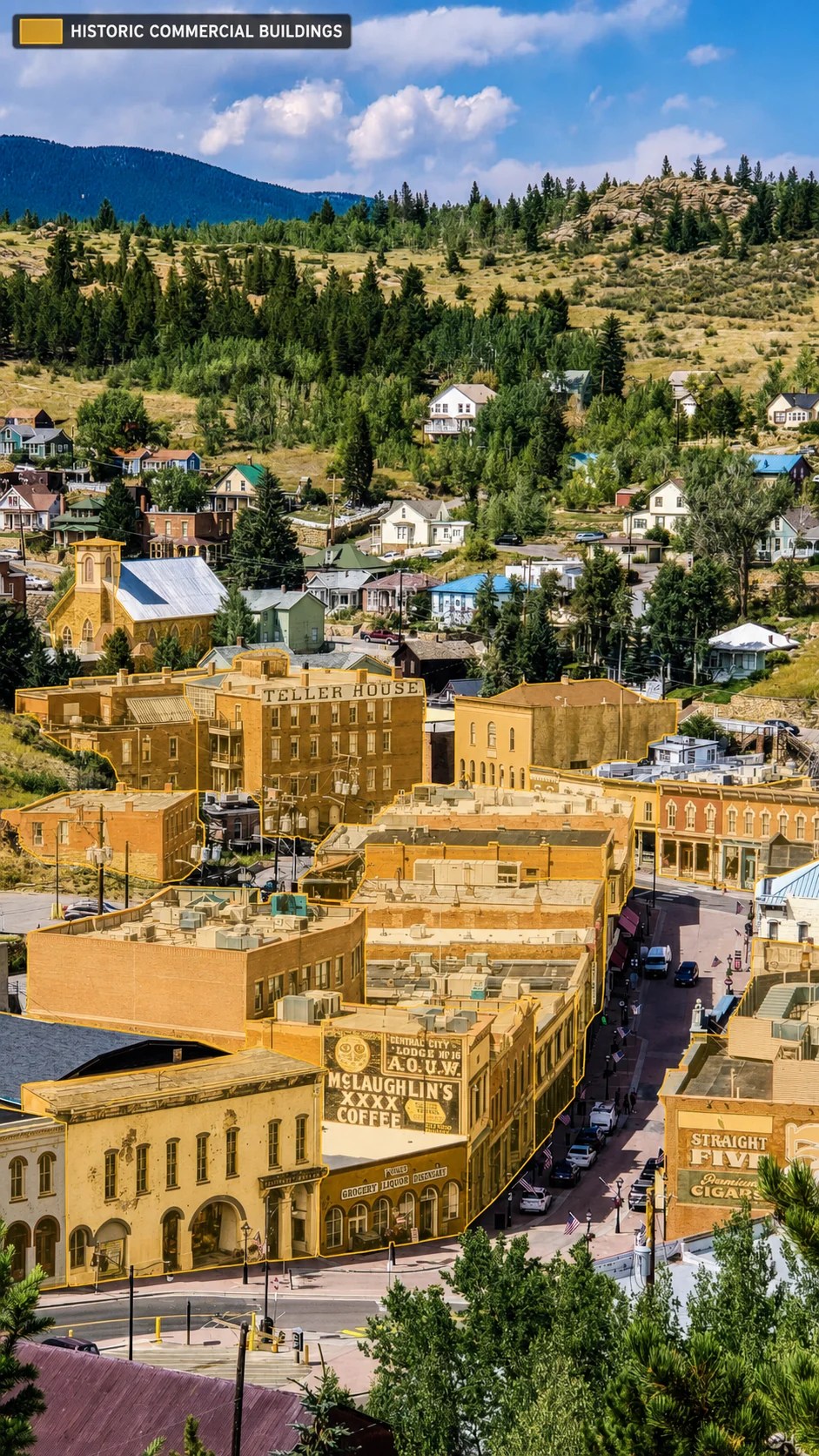 HISTORIC OVERLAY
Preserving architectural legacies while establishing clear physical growth boundary regulations in delicate central historic districts.
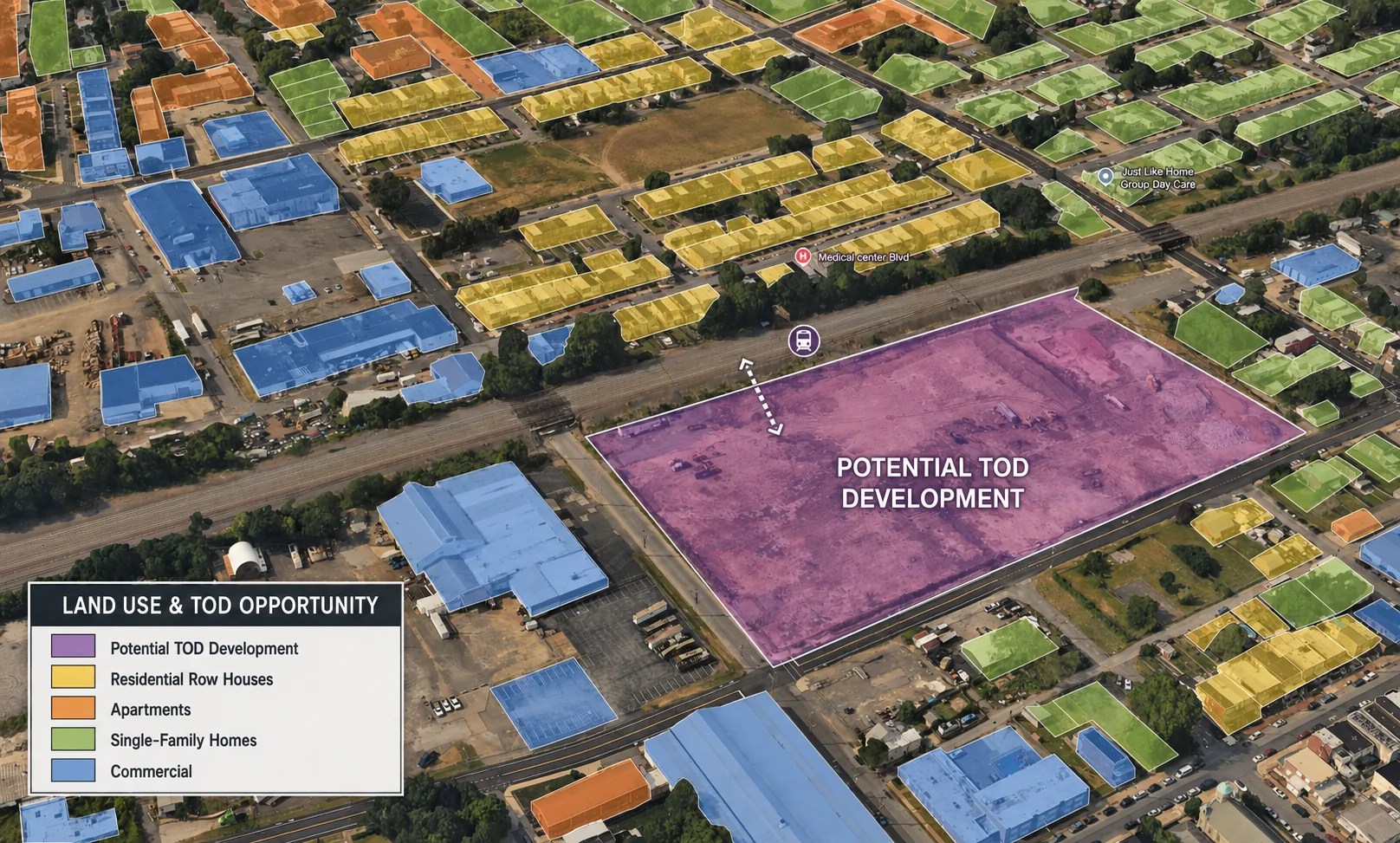 LAND USE & TOD
A detailed multi-modal transit analysis designing high-density development models adjacent to the primary Booth St light rail node.
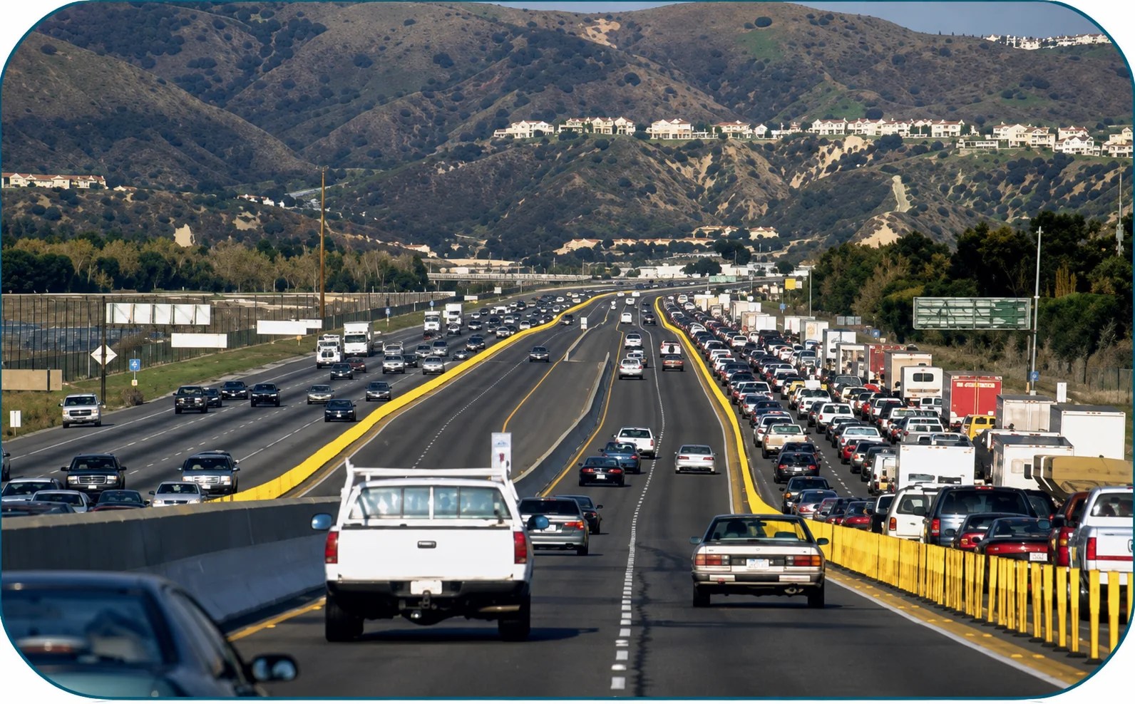 INFRASTRUCTURE STUDY
Regional accessibility metrics mapping arterial complete-street revisions and environmental catchment parameters along the major highway corridor.
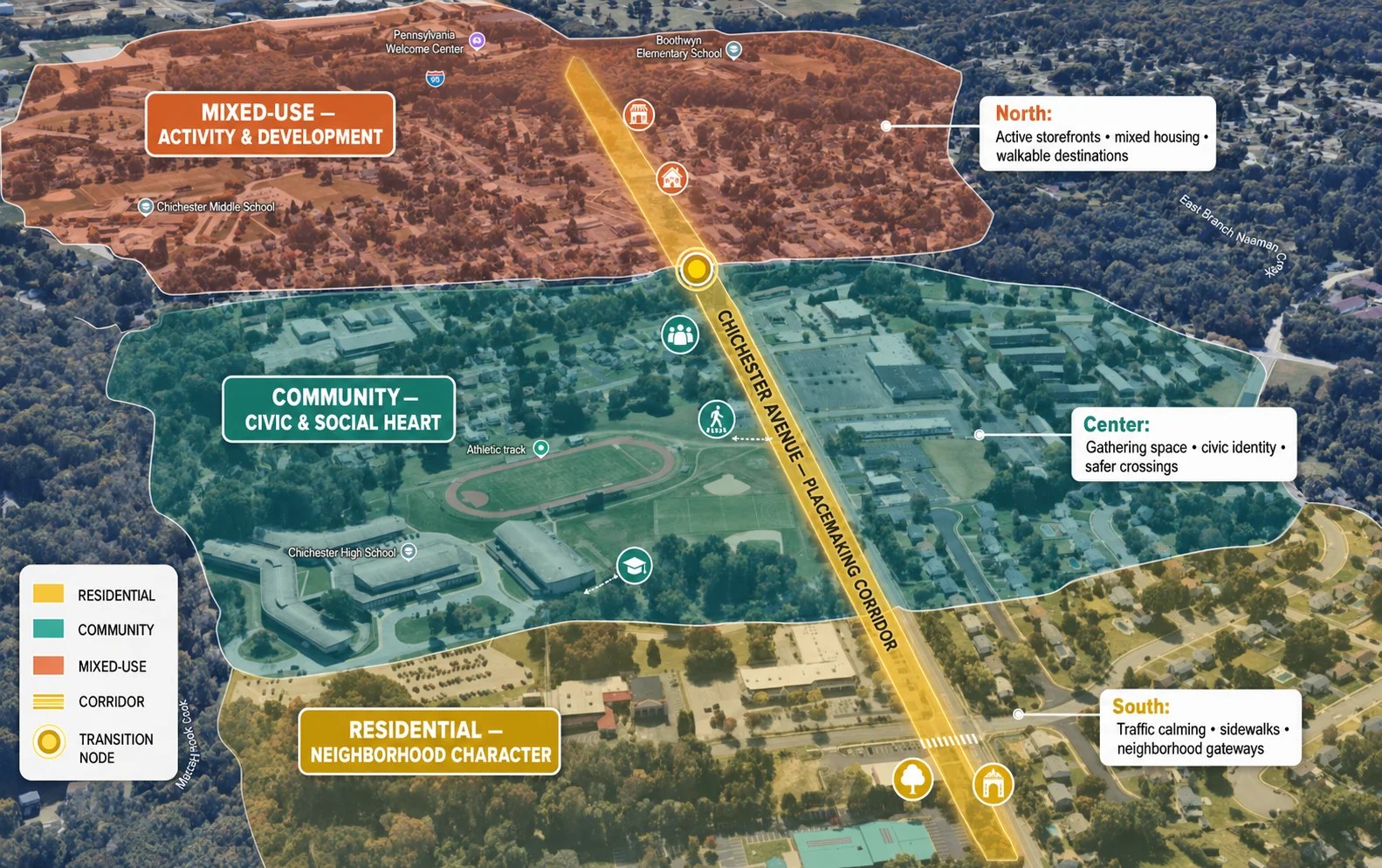 STREET DESIGN
Proposing multi-use dynamic sidewalks, safe pedestrian pathways, and urban green storm water solutions to optimize accessibility corridors.

An empirical spatial economics study analyzing commercial real estate valuation changes relative to distance and pedestrian walkability metrics surrounding high-impact LA Metro transit nodes.
Explore Other Projects